Day 4 : Masaka – Malegolonyane
————————————————-
“Whilst you are on the spur look westwards towards the mountains. Below you you will see a floodplain. In the distance, on the far side of the flood plain (if your eyesight is good) you will see a tar road that is fairly busy. You are wanting to head to the point where this road leaves the flood plain on the right”
Though the exit from Masakala would be tricky in the dark it made sense to get to the spur in the dark so I could see headlights of the cars. The ladies at the guest house assured me I wouldn’t bugger it up.” Down to main street, lefty then straight”
My alarm went off at 0515, the ladies had my bacon and eggs sizzling while I packed my gear (not a lot to pack when travelling so light) and I checked my bike over, it felt bloody cold outside. At 0530 I was stuffing my face, enjoying the sponsored Freedom challenge coffee and filling my flask for later (defiantly worth the extra 300g). At 0540 I was on the road, having a support station to myself certainly made things slick in the morning. The ladies were right on time with my breakfast at the time I’d requested it.
Down to main street, lefty then straight, I passed what looked like a large building on my right, but couldn’t really tell if it was a school. Luckily a local was making a cooking fire outside of his house, he confirmed that it was the school. A little back track and I was back on the correct road past the school and soon descended onto the flood plain and could see the car lights far off in the distance, just making out the silhouette of the valley behind them. Though bad for South Africa the recent drought was good for me as the flood plain was in fact a trickle of a river and the occasional sand. At some point the track ran parallel with the road and I saw an embankment behind some reeds. I thought it smart to take a short cut through the reeds to save some time, the road had to be better riding than the track and grass of the flood plain.
It didn’t take long until I was knee deep in ice cold water and fighting through the steadily thicker and taller reeds. Eventually I gave up when I realised it wasn’t an embankment but a wall of reeds that got steadily taller, it was impossible to push through to the road. So I back tracked and continued the long way round, another 15 minutes wasted and the discomfort of cold feet. This was an eye opener to the potential misery of the Ossenberg jeep track through Mordor later in the trip.
The road was busy but at least I could cycle properly again, sadly the extra speed meant I cooled right down and my hands and feet started hurting. I’d learned during previous trips that the only way to warm feet is to walk. I would ride for five minutes then walk for one, each time the ice on the outside of my shoes cracking and breaking off when I started walking. What I should have done was stop and put my Sealskinz socks on. But, I figured they would just get wet too and take forever to dry, the sun was out, it would only be a matter of a couple of hours before my feet and lightweight socks were dry….Stupid, Stupid Stupid. When I did stop for coffee and sun at 9am I noticed that my leggings were not covering my socks…bugger windchill on my ankles. On closer inspection the front of my ankles were still blue/white and getting itchy. The itchiness and soreness would hassle me for the rest of the trip until all the dead skin dropped off. A couple of hours of cockiness and being over confident had caused frostbite on the top couple of layers of skin, something that didn’t happen during my winter trips because I was sharp and expecting it. The last thing I expected in Africa so I wasn’t paying enough attention.
The rest of the morning was endless walking, riding and pushing through grass plains and through the various villages, meanwhile teasing the dot watchers by heading to within 1-200m of the out of bounds areas.

“Cross the stream and head up onto the ridge ahead – from here you can look across the floodplain below to see Queen’s Mercy store. Follow one of the paths down the ridge and across to the store.”
“How am I supposed to know which of the buildings in that village over there is the friggin’ shop….”. I would also later find out that the shop has been closed for a couple of years, so the cold drink I’d been looking forward to for hours didn’t happen either. The narrative throughout the Freedom challenge proved very erratic. Sometimes spot on to the meter, sometimes comical in its irrelevance (if you go left you’ll see this, that and come to this village or farm, don’t turn left, turn right) sometimes outdated or just wrong(especially distances) and it often seemed written by someone that knew the route so well that they assumed some land marks were obvious to riders. Great if you’re riding it again, a real pain in the arse if you’re riding the FC for the first time. In my opinion the narrative is well overdue a facelift.
“There is a radio tower off to the right. On the ridgeline above the intersection is the Makhulong Lodge”
” Which tower? I see two? above the intersection? the ridge line is a kilometre from the intersection…”
“At the intersection turn right and then keep left so that the radio tower is on your right hand side and you follow the small road that climbs up to the top of the ridge line where you will pass the access road to the Makhulong Lodge off to your left”
 The next 2-3 km took me an hour or so, constantly looking at the map and trying to make it match the narrative. Even asking locals 300m from Makhulong Lodge didn’t help, they’d never heard of it. The only saving grace was an air photo of the hill top which confirmed I was on the correct track…I hoped.
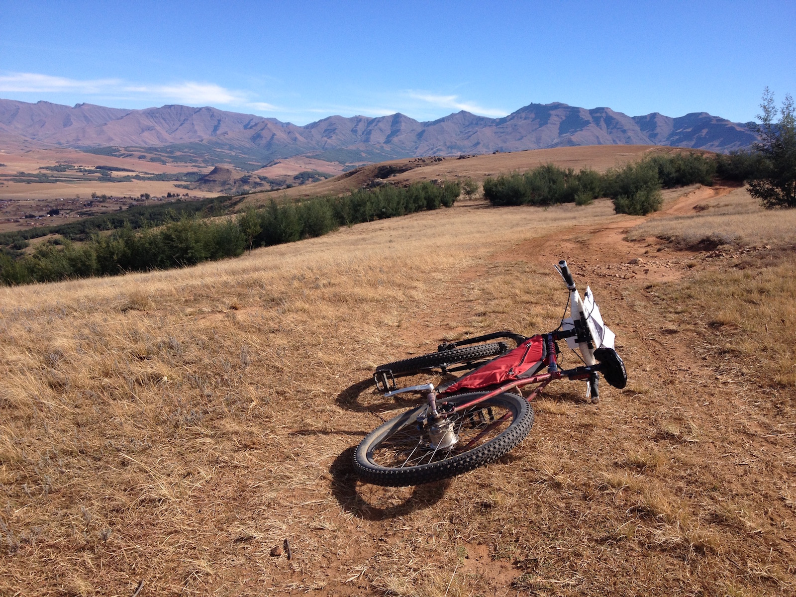
Once on the ridge line I was convinced I was where I was supposed to be. Though a little disappointed that I’d once again wasted a huge amount of time getting nowhere, I cracked on enjoying the stunning views.
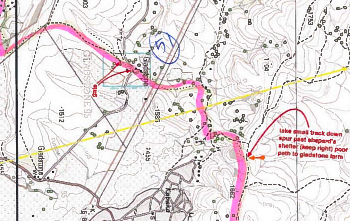
 “The track drops through a saddle and then climbs again in a very wide erosion scar. At the top of this stiff little climb stop and look around you. Ahead of you the track drops down to an area of light grey shale and then climbs steeply again. The Twins lie to the north. Off to your right is a small valley. On the far side of the little valley is a spur that runs down towards the Gladstone Farm. Following the line of the spur further you can see the Mariazell Mission in the distance and a faint track running from Gladstone Farm towards it. Continue down to the foot of the next climb where there is a very indistinct footpath that turns off to the left and then runs around to the right to get to the spur running down towards Gladstone Farm.”
I’d dropped down through a saddle and climbed across an erosion scare, the distance seemed a little short but I’d lost all faith in the narrative and its distances. Ahead of me I saw light rocky ground that could be called shale. I was on a ridgeline full of spurs, “WTF, lets use a spur as a landmark…fuckers…” I saw plenty of farms and wondered which was Gladstone, I guessed Gladstone was supposed to be as obvious to new riders as the Queen’s Mercy store. My frustration at the narrative and the lack of a second opinion was obviously now getting to me. I knew many people have dropped off the ridge too early in the past so I was very careful not to drop too early, therefore I pushed on a little. I found three mtb tracks heading left(race to Rhodes riders?). “Ha mugs, they dropped way too early, this is the wrong side of the spur…”
I pushed on a couple of hundred meters and found a track that ran past a disused shepherds shelter. Relieved that I’d found it I bolted down hill ( a dot watcher on Twitter suggested I might be using a wing suit), it was going too smooth…… all of a sudden ouch…..”Fuck, my ankle wasn’t happy about that” I was half way down the mountain so decided to rest my ankle for five minutes and used the time to check the map and find some landmarks.
“Wait a minute, on the map Gladstone is a lone farm, thats a whole friggin’ village down there……Fuck fuckity fuck fuck, I’ve blown it again…” My plan of having an early finish and a few beers in the sun at Malegolonyane just went up in smoke. Though I’d dropped down off the ridge way too early, by being above the village I knew exactly where I was so started contouring around on the goat tracks until I would eventually pick up the correct path. It soon became obvious that contouring doesn’t work as you end up walking in and out of every gully and around every spur, adding a huge distance and pissing my ankle off more by the minute. The obvious solution was to drop down the the village and pick up one of the tracks heading across to the spur I should have originally taken. Boom, 30 minutes later I was descending towards Gladstone.
“Nearing the bottom of the descent you leave the wattles behind you and the valley bottom is directly ahead of you. You can either keep following the track down to cross the stream or stay about 100 metres above the valley bottom and head off to the left to the point where the ridgeline meets the same stream. Directly opposite it is the Gladstone farm house. Cross the stream and head up to the Gladstone farm house”
Boom, skid, jump, the descent was good fun, through the river and up, great I’m on the narrative again. Five minutes later I was thinking ” I should have seen the farm by now, where’s the sun…in front…bugger” I checked my compass and I was heading West, bugger. Just then I spotted a shepherd, so asked him if he knew where Gladstone farm is. He pointed exactly where I expected he would. ” Good, I’m not totally stupid then.” A little cross country and I found the farm. Back on narrative and I left the farm and found the nice track and cracked on.
” Turn right on the farm vehicle track as it goes up towards and then through a cattle kraal until it eventually reaches a gate just before some large trees. Pass through the gate and then continue on the track that runs up the right hand side of the trees. The track then runs through the veld slowly climbing up the hill. After about 2 kms the track splits.”
“Gate, check. Tree’s check, gate- tree’s, Check, Climb..hmm sort of. 2km later, where’s the split, hmm thats a river and not a split. map, compass. Bugger cycling towards the sun again instead of South….FFS….” I took a quick bearing just off South which would bring me to the correct track on the map, threw my bike on my shoulders and stomped through the grass up hill until I was back on track. Though I was making simple nav errors, each time I was spotting them quickly and recovering, Unlike Ntsikeni where I was briefly on another planet and had no idea where I was despite only being 300m off course. Now I knew exactly where I was but just in the wrong place. I could still look myself in the mirror that evening 🙂
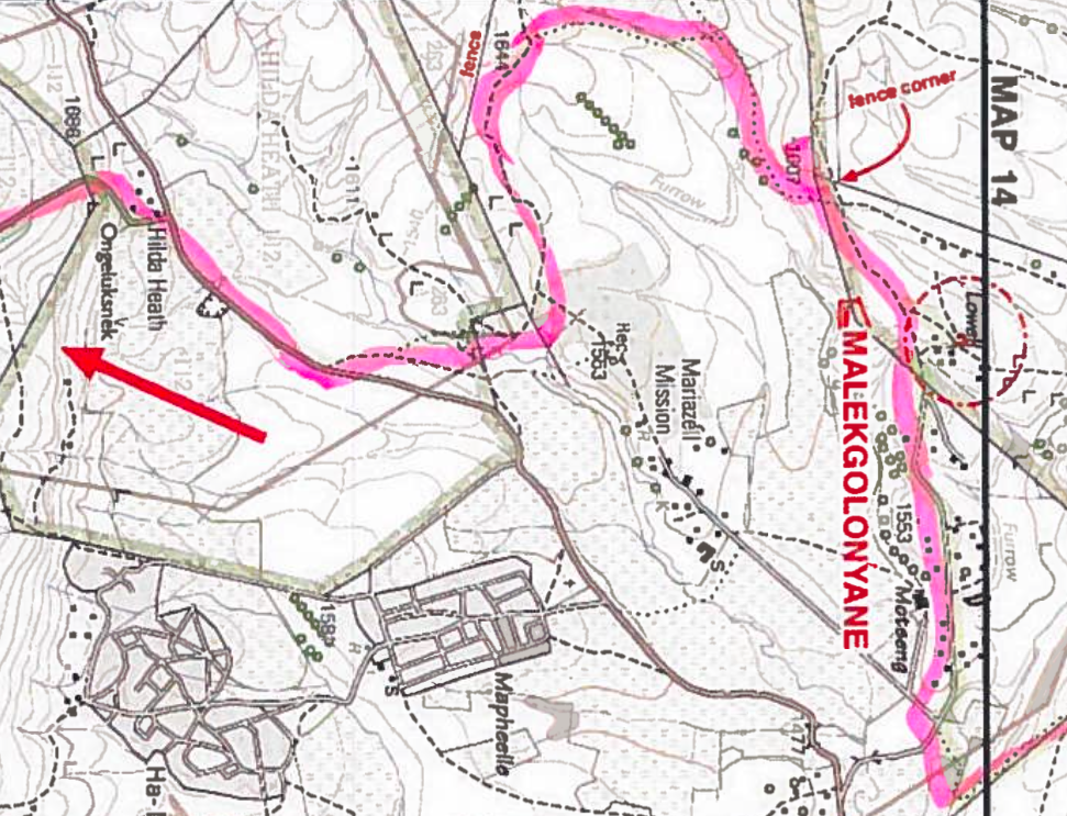
Fence line, tiger line down to the main access road and things were looking good for actually getting to Malegolonyane before dark. By now I was pretty broken, sore knees, twisted ankle and about done energy wise. Finally being on a concrete road again felt fantastic. Well, for the 30 meters before it went up hill. I wanted to cry, why oh why did the last 2.5 km have to be up hill, I was done.
30 minutes later I was at the lodge at 1455. I opened my box of goodies, had a quick drink and some vetkoek and contemplated my options. I really just wanted to eat and sleep. But the next morning would be a tricky exit in the dark. At Malegolonyane there is the option to do the Stations of The Cross exit as far as Ongeluks, meaning you do a loop on arrival according to the narrative then the next day just bolt down the main road to Ongeluks as you’ve already covered the FC route up to that point. I really didn’t want to do it, but with my track record it made sense to suffer now in daylight and have easy nav rather than do it in the morning in the dark. 90 minutes later and via a quickly recovered detour (arriving at the mission was a clue I’d missed the turnoff) I was done. Climbing the last 2.5km uphill again was probably the hardest part of the whole FC for me.
I could finally relax.
Copy/paste from the RC race report that day :
“He arrived at the support station at 14h55, a few hours later than expected and after a short break, he did the Stations of The Cross exit to the Ongeluks road to set himself up for an early, trouble-free exit in the morning. He arrived back at the support station at 16h35.
That raises an interesting point. Shane took 11 hours to advance 58kms down the trail. At face value, it looks ridiculous as you would imagine you could walk it in that time making a bicycle superfluous. When someone asks how far it is to any given point on the trail, the correct answer should be given in hours rather than kilometers. The distances bear no relation to the time it takes to cover them. ”
I’d finished my toughest day of the Freedom Challenge, only 20 toughest days to go.


Oh my. Those internal monologues have a ring of familiarity. I don’t think any FC rider has escaped those rants at the maps, the narrative and our own idiocy.
haha 🙂